Due to the recent tragedies caused from Hurricane Helene, please check if hiking trails are open or not before venturing out. For more information go to: www.nps.gov/blri/planyourvisit/nc-trails.htm
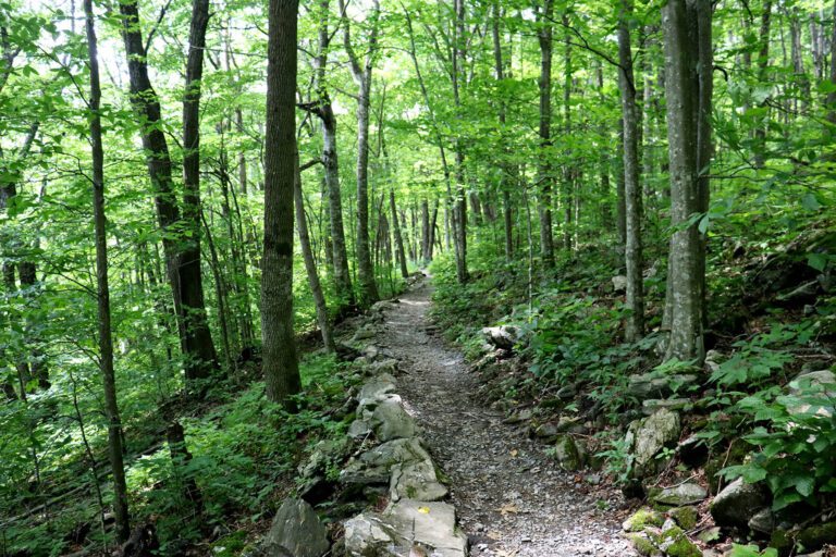
The High Country is perfect for an outdoor excursion. There are hundreds of miles of hiking trails to explore with varying lengths, terrain and difficulties. From shimmering streams to a vast array of flourishing wildlife, there’s so much to see when hiking in North Carolina’s High Country. Here are some of the area hiking trails (in order of milepost).
217.5 Cumberland Knob Trail: Great for stretching your legs after a long car ride on the Blue Ridge Parkway. Hike, picnic or just enjoy the thousand-acre park where Parkway construction began. Site of the northernmost visitor center in North Carolina. 0.5 mi.; Easy
230.1 Little Glade Millpond: Looking for the ultimate spot to unwind without having to hike very far? Little Glade Millpond is less than half a mile long and features a delightful pond near an old turbine mill, creating a scenic view that’s too beautiful for words. The water is smooth as glass, and a picnic area completes the scene making for a perfect place to stop for lunch. 0.4 mi.; Easy

238.5–244.7 Doughton Park: Site of the Brinegar Cabin, built in 1880 and inhabited until the 1930s. The restored cabin sits on 7,000 acres of land, boasting 30 miles of hiking trails. Popular activities include trout fishing, hiking and cross country skiing. Also, a great place to spot wildlife. 30+ mi.; Varied Difficulty
271.9 The Cascades Trail: This turn-around trail will lead through some of the most scenic views in the High Country. Follow this easy-access path to the beautiful Cascades waterfalls. 0.5 mi.; Moderate
293 Moses Cone Manor and Memorial Park: Tour the summer home of textile magnate Moses Cone, also known as the Denim King. Today, the manor is home to the Southern Highlands Craft Guild, with quality crafts and art for sale and on display. Many hiking and horse trails to explore.
295 Julian Price Park: Experience camping, fishing, hiking and more. The once retreat of an insurance executive also features an amphitheater, lake and grills. Take the Green Knob Trail to see wildflowers, deer and birds. 2.5 mi.; Easy
302.4 Tanawha Trail: You don’t have to travel to lands afar to get the experience of a tropical forest. Lush with many different types of greenery and surrounded by nature’s peaceful woodland creatures, Tanawha Trail is a treat for the senses with some of the best views around and the sound of the fall of Boone Fork in the background. 3.2 mi.; Moderate
304.4 The Linn Cove Viaduct: The most photographed section on the Parkway and the last piece constructed, the Linn Cove Viaduct is known as an engineering marvel due to its litheness in winding around the mountains. Check out the visitor center, and hike down for a view of the complicated yet scenic bridge. 0.16 mi.; Easy
306 Grandfather Mountain Overlook: Find the best views of the mountain here and see if you think the mountain resembles a hawk. Its Cherokee name is “Tanawha,” meaning hawk. Many trails of varied difficulty.
308.2 Flat Rock Trail: This brisk 30-minute round trip trail to Flat Rock is ideal for hikers of any level and is highly recommended for its fantastic views. Below is Linville Valley and towering high above are mountain peaks including Roan, Hump, Grandfather and more. Pack a lunch in your knapsack, because this is a view you’ll want to savor for a while. 0.6 mi.; Easy
316.4 Linville Falls/Gorge Trails: The lower falls plunge 80 feet into Linville Gorge, the deepest gorge east of the Mississippi River. The rugged area is great for hiking, camping, climbing and more. Linville Falls Trail: 0.8 mi.; Moderate. Linville Gorge Trail: 0.5; Strenuous
320.8 Chestoa View Trail:Any time of year is suitable to hike this gorgeous trail, but the fall proves to be the most popular since the valley is covered with leaves that change to a rainbow of hues during this season. Enjoy fantastic views and stop for a picnic at one of the tables available for a meal outdoors. 0.6 mi.; Easy
339.5 Crabtree Falls Loop Trail: Marking the last stretch of the Parkway through the Blue Ridge Mountains, this hike is made for the more experienced hiker. Remember that while it may be a calm hike down, this loop will be a steep climb back uphill. 2.6 mi.; Strenuous
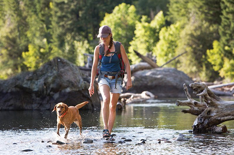
Hiking Safety Tips
- Use a map. Always know the quickest and safest route back to civilization.
- Wear sturdy, worn-in boots or shoes able to handle rocky, uneven and slippery surfaces.
- Bring a daypack with food, water, first-aid supplies, rain gear, extra clothing, cell phone, compass and flashlight.
- Stay alert for changing weather patterns. High peaks are especially at risk for lightning strikes.
- Keep kids in the middle of the group so they can’t be left behind or wander off.
- Read any regulations for the area you are hiking.
- It is a good idea to bring a loud whistle for emergency situations.
- Don’t attempt a hiking trail that is too advanced for you. If you don’t exercise regularly, a moderate or strenuous trail could be dangerous for your health and leave you stranded midway.
- Hike with at least one companion.